Introduction
Dada Nagar Kheda
 
indexhn.html
indexhr.html
!!!......Wherever the word "Haryana" is used on this website, it is meant for modern Haryana, Delhi, Western U.P., Uttrakhand and Northern Rajsthan in collectivity. After the first independence revolution of India in 1857 this region was divided into four parts and keeping Delhi separately rest were merged into neighboring states by British rulers for their political and business purposes........!!!
You are here: Home > Introduction > Dada Nagar Kheda
Dada Nagar Kheda Bada Bir Nidana - A Glimpse
Dada Nagar Kheda Bada Bir:


On the holy land of Haryana (the Khapland) wherever a new village is established first ever time, a foundation stone is laid at a proper and most suitable place seemed at that instance. And that very place becomes the founding center of village onward until the existence of that village i. e. forever, which is called as "Dada Nagar Kheda Bada Bir" in local language. To read and know in details about Dada Nagar Kheda please refer to this article.

In the below note, it is written about the geographical to referential and other major definitions around the village necessary to know as a first glimpes about the Dada Nagar Kheda Nidana i.e. Nidana village.
Honorary founding shrine of Nidana Village - "Shri Dada Nagar Kheda"


Location and Climate:


Geographic Location: Nidana village is situated in countryside, 700 meter inside to Haryana state highway number 10 in India. On this highway, it is 14.9 kms east of Jind and 29 kms west of Gohana. It is 201 kms away from state capital Chandigarh and 120 kms from national capital Dilli.

Located at the south-eastern periphery of district Jind; village has an outer circular ring road (called as “Firni” in local language) and internal circular grand street (called as “Kehsuda Gali” in local language) like any other Haraynavi village. There are 17 linking streets connecting Firni to Kehsuda Gali.

On geographic scale village is located at 29.14° north, 76.27° east on an elevation of 228.74 meters (748 feet) from sea level, which is 1.74 meter higher than its home district Jind’ elevation from sea level.


Border Sharing Villages (Guvhaand): Lalit Kheda and Bhidtana in north-east, Chabri in north, Kharak-Ramji in north-west, Nidani and Padana in West, Dhigana in south, Bhairon Kheda in south-east and Nijaampur and Ludana in East.


Google Map Location

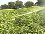
Climate: Village has seasonal circle of weather from spring, summer, and monsoon to winter. Though the village itself is situated on a slanting curve, making the older core village invincible to floods but fields being the deepest down plains of surrounding area are most suitable to flood. Please refer to “Water-Infra” section of “Infrastructure” page and “Agriculture” page for more details.


Institutional References:


Constitutional Reference: Nidana village falls under the Julana legislative constituency of Haryana State Assembly and Sonipat constituency for Indian National Parliament, having district and sub-divisional offices at Jind and state zonal office at Hissar. Village falls under official judiciary court of Jind. For in detail knowledge on this topic please refer to “Panchayat-Admin” page of website.


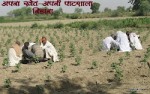
Professional Reference: In professional terms of village, there is no socally recognized “SERVANT - OWNER” kind of system in Nidana. Servants & agricultural laborers working at one’s home or fields are, considered “Seeri-Saajhi” by each-other rather than owner-servant (“Seeri-Saajhi” means partner in day to day life from eating to farming, happiness to sorrow). This is the standard system of professional relations in Nidana though exceptions are found everywhere else or otherwise there would be no court, panchayat and/or police on earth. Read in detail on this at “Agriculture” page.


Social Reference: Other than religious and social beliefs, there is no census accepted or accredited in Nidana which depicts the supremacy of a single inheritance like a King/Amma etc. versus Greeb-Janta (Hapless Public) kind of relation/rule/power or any other such proclamation as might or may else or otherwise seen or observed by individuals in day to day life or through any communication medium like radio, T.V., Cinema or movie. Also there is no discrimination or binding in standard norms of village for calling or abusing someone on the basis of caste or religion. Relation bands are defined on lineage system in castes under which if you are defined as uncle then you will be called uncle throughout the castes and same way for all other socially defined relations. Every girl is considered as the daughter of village and on standard social norms of village, it’s the responsibility of each and every villager to protect this right of village’s daughters.


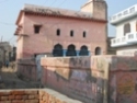
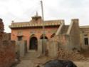
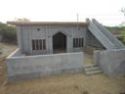
Landmarks and Landscapes:


Parases (Choupals) Community Landmarks: Parases are used for organizing meetings of village panchayats (councils), for political rallies, as Dharamshala for unknown and surprise visitors, as Barat Lounge, as Aangad Waadi and elder education centers. These are also used as amphitheaters for Folk artists to hold their concerts or enact plays. Village has following five Choupals situated at different locations:

Cental Paras
South-Central Paras
Western Paras
North-Western Paras
Govt Community Hall
The oldest and biggest historical community monument of village. It is situated at the center of village at Sadar Gali.
The second oldest community monument of village, situated at adjoining of Harijan and Savarn residences
The third oldest social landmark of village, situated at the center of Harijan colony (basti) of village.
Newest and recently built community center of village, situated at its north-western corner.
The community hall built with government aid, is situated at northern external periphery of village.


Religious Landmarks: There are two types of religious believes, common and individual/group specific.
  • Common: Dada Nagar Kheda, Debi Maai and Arya Samaaj
  • Individuals: Dada Sat Sahi Nirankar, Daadi Chorde, Googa Peer, Sayyad and some others.
Please read about each of these in details on “Culture” page.


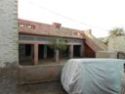
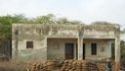
Educational Landmarks: There are five schools, out of which two are governmental and three private. Read about each in details on “Infrastructure” section.


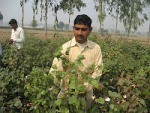
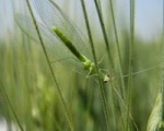
Natural Landscapes: Village has very rich flora, fauna and natural resources; you can read about it in details on “Agriculture” section.


Note: More points will be added in topic according to time and new content developed.


Jai Dada Nagar Kheda Bada Bir


Author: P. K. Malik

First Edition: 19/04/2012

Publisher: NHReL

References:
  • NH Advisory Board
  • Google Map Services

Share
 
Farmer Field School

25. जिला स्तरीय खेत दिवस का आयोजन


निडानी में संपन हुई २०१३ की खेत-कीट-पाठशाला
InfoDesk - Enquiry
Enquiry InfoDesk facilitates you with best public uitlity weblinks of Indian and Haryana State system and services of public course and economy. NH terms & conditions applied.
Public Enquiry
Economic Utility
Money and Life
Economy and Currency Rate
Stocks and Exchange
NH Banners & Messages
“Say no to Dowry”
Eliminate this sex inequality!
Human purchases vegetables, cattle even all routine courses in hand to hand give and take deal then why this blunder mistake in marriages that only girl’s side will pay and that too in double costs in terms of daughter and dowry both? Lets stop this male dominance and female discrimination. - NH
 
“Adore the girl child”
Say no to female foeticide!
If you can’t bear the birth of a girl child in your family, you should not expect a bride for your son. Invaders are gone, lets bring  back our divine period of Vedic times for our females. - NH
 
“Lead the Change”
Keeping the system of discussion alive!
Moving with time and adapting the change is the only key to sustain civilizations. - NH
© Nidana Heights 2012-19